
Free App No sign-up No ads


Korea drone no-fly zone map
NOTAMs and weather for any point.
Pick a point. See the limits. File if needed.
Android now, iPhone after review. English, Russian, Korean, Japanese, Chinese.
NOTAMs as of 00:00 KST Zone snapshot daily. From Seoul to Jeju.
How it works
From a place name
to a clear answer
-
Pick a place
Search for an address or drop a point on the map. You can also check a circle around it: 100, 250 or 500 m.
-
See what applies there
No-fly zones, airports, parks, heritage sites and temporary bans: at what altitude and until when.
-
Find out what to file
The answer takes your drone, altitude, time of day and filming into account and tells you whether you need a permit. Applications go through Drone One-Stop.
Abbreviations and terms
- P and R
- Prohibited and restricted areas of airspace.
- CTR and ATZ
- Control zone and aerodrome traffic zone: the airspace around airports and airfields.
- NOTAM
- A notice from AIM Korea about a temporary restriction or ban. The app shows its altitudes, validity and original text.
- VLOS and BVLOS
- Flying within and beyond visual line of sight.
- 비행승인 and 항공촬영
- Flight approval and aerial filming permit. The names stay in Korean: applications are filed under them.
How it looks
Screens from
the app
-
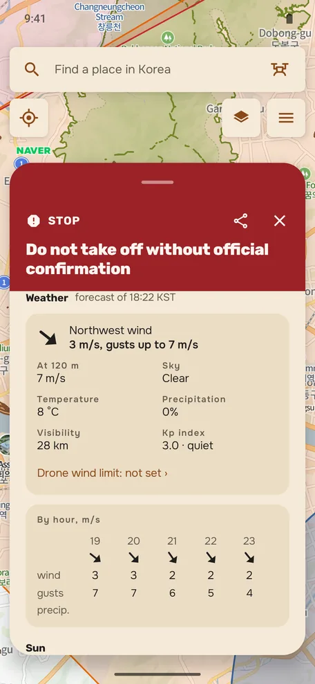
Weather and sun for the point -
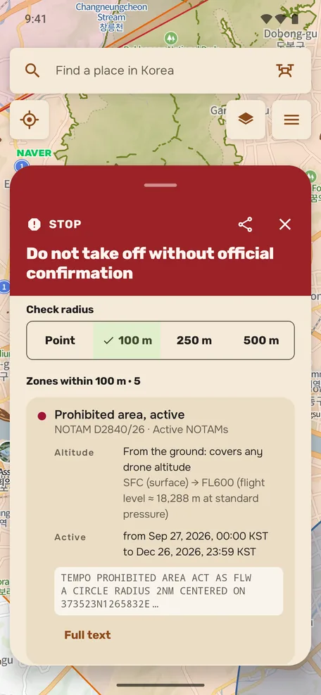
Zones near the point: altitude and validity -
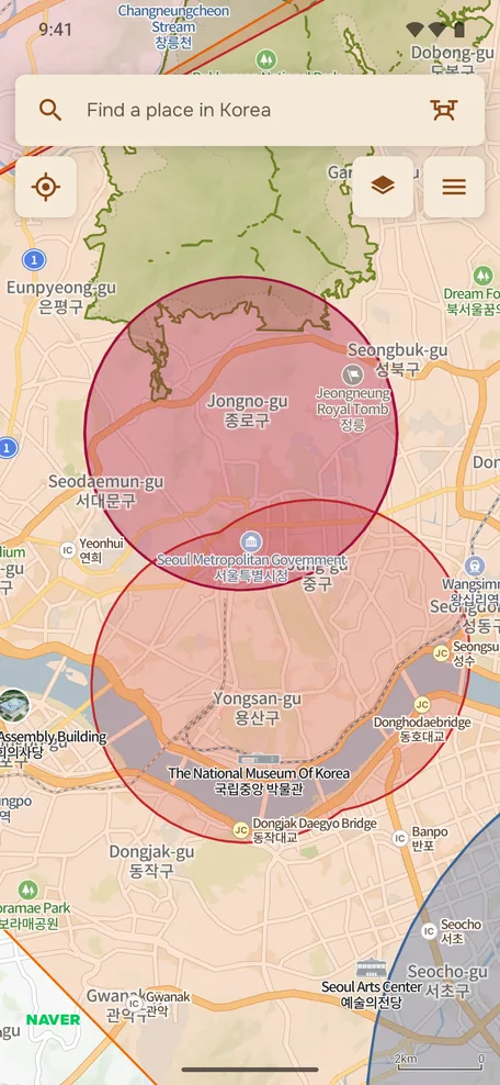
Map with flight zones -
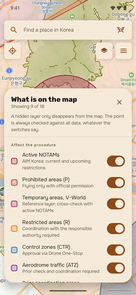
Layers and legend -
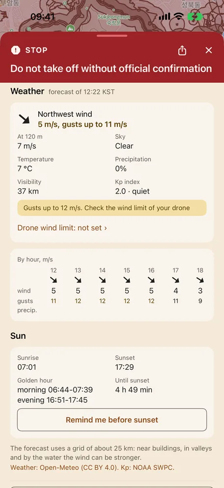
Weather and sun for the point -
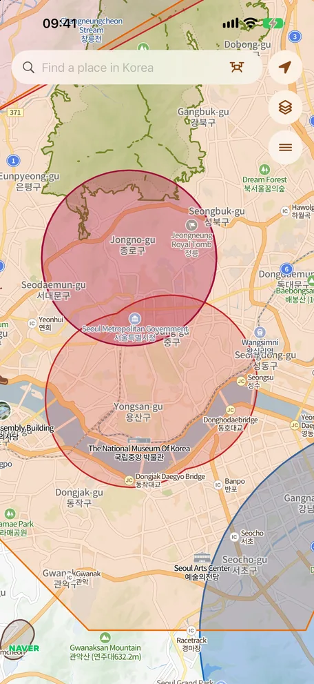
Map with flight zones -
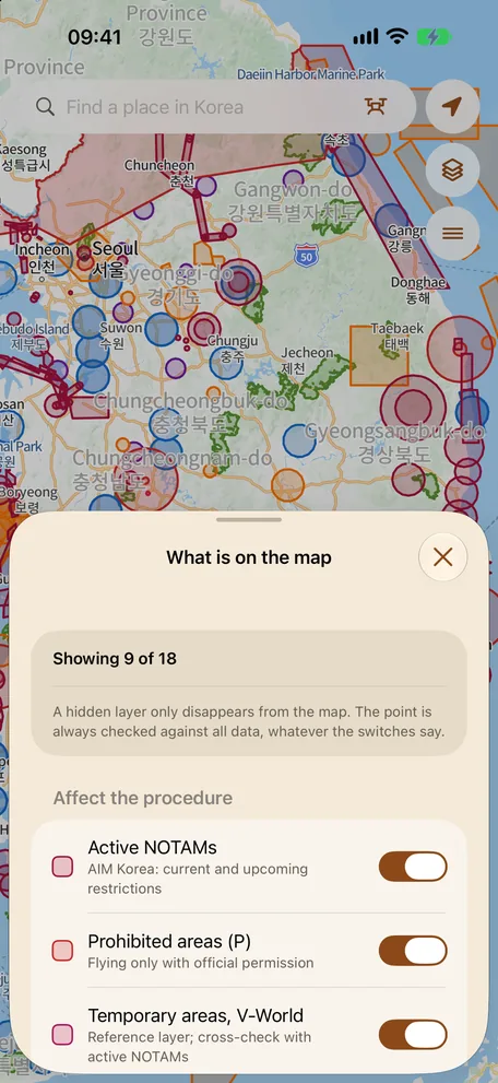
Layers and legend
These are screenshots, not a working map.
Get the app
Free, with no sign-up and no ads. In English, Russian, Korean, Japanese and Chinese. The iPhone version is awaiting App Store review.
Where the data comes from
Every answer
shows its date
- 국토교통부 브이월드updated daily
- AIM Koreaupdated every 10 minutes
- OpenStreetMaplive requests
- NAVER maplive SDK basemap
The data is a snapshot taken on the stated date, not a live feed from the authority.
More about the sources
| Source | What we take | License or basis |
|---|---|---|
| 국토교통부 브이월드 | Aviation zones, aerodromes, national parks, cultural heritage sites | KOGL Type 4 (zones), Type 1 (heritage) |
| AIM Korea | Active and upcoming NOTAMs | Aeronautical information publication |
| OpenStreetMap | Place search and auxiliary geography | ODbL 1.0, © OpenStreetMap contributors |
| NAVER map | Basemap inside the app, place and address search (Local Search, Geocoding) | Official NAVER SDK, terms of service |
Snapshot dates are read from the published data manifests. The full list of third-party materials and license texts is in the license notices.
Limits of applicability
The app helps you prepare an application, but it does not grant permissions and does not replace Drone One-Stop. Private and local restrictions are not in the data; only the authority gives the final answer.
Official Drone One-Stop serviceWhat the app does not do
- Does not replace Drone One-Stop비행승인 and 항공촬영 applications are filed and reviewed only in the official service. The app is preparation for the application.
- Private and local restrictions are not shownLandowner rules, municipal orders, park administration and police instructions are not in the data.
- NOTAMs without explicit geometry are not drawnIf a message has no coordinates and radius, it appears in the list as text, not as a shape on the map.
- Park and protection zone boundaries are simplifiedNear the boundary itself a divergence from the official outline is unavoidable. Verify against the source.
- The data is a snapshot, not a live channel of the authorityThe situation may have changed between the snapshot and your check. Only the authority gives the final answer.
Questions
Before your
first flight
Is the app free?
Yes. Installing and using it costs nothing: there are no paid features, no subscription and no ads, and you do not need an account.
Does my drone need a permission?
It depends on the aircraft mass, the place, the altitude, the time of day and whether you film. The app shows which zones the point touches and which procedures they usually involve: 비행승인, 항공촬영 or registration. The decision is made by the authority on a Drone One-Stop application, and only its answer has legal force.
What does 4종 mean?
It is one of the categories into which Korea divides drones by maximum take-off mass; each has its own paperwork and operator requirements. The app suggests which category and which procedure most likely apply to your case. The exact conditions are with 국토교통부 and Drone One-Stop.
Why does the app not grant permissions?
Because it is a reference tool, not a government service. The developer does not represent the Government of the Republic of Korea and is not affiliated with any government agency. The app answers about zones and procedures; the authority reviews the application.
Who runs the site?
Semen Kim, an independent developer. NOTAMs are refreshed every 10 minutes and the zone snapshot usually once a day; the snapshot date is shown in every answer. Errors in the data: [email protected].
Where do the NOTAMs come from?
From AIM Korea publications. The app stores a snapshot and refreshes it on a schedule, showing the original message text, altitudes and validity period. Messages without explicit geometry are not drawn on the map and stay in the list as text.
What happens to my coordinates?
The point check runs on the device itself: the coordinates of the point and of your location are not sent to our server. The network carries place search queries and the NOTAM, weather forecast and zone snapshot downloads, and the NAVER SDK loads the map for the visible area like any map does. No account is needed, no check history is kept on our side (the web map keeps recent and saved points only in your browser), and there are no analytics or third-party trackers in the apps. Details are in the privacy policy.
Will there be an iOS version?
Yes. The iPhone version is awaiting App Store review. When it is out, the link will appear on this page. We can't promise a date: it depends on Apple's review.
Does the app work offline?
Partly. The zone snapshot and cultural heritage data are stored in the app, so a point can be checked offline too, but the answer is marked “Incomplete check”: NOTAMs, the weather forecast and place search come only from the network, and NAVER loads the base map for the visible area. The app has a weather forecast for the point and a reminder before sunset; there is no flight log and no application filing: applications go through Drone One-Stop.
Flying to Korea?
Guides
- Drone laws in South Korea
- Flying a drone in Seoul
- Flying a drone in Busan
- Flying a drone in Jeju
- Bringing a drone to South Korea
- Why DJI's map shows different zones in Korea
- Apps for checking drone zones in Korea
- Flight approval: preparation and application steps
- Drones under 250 g in Korea: what is and is not required
- UA zones and drone parks in Korea
Check the spot before your next flight
